Interactive 3D & Digital Twins on the Web: 3DGS and WebGL in Architecture
Author: Ruumica Engineering · Spatial Reality Capture & Systems
Published: October 28, 2026 · Category: Interactive 3D & Digital Twins
Sharing high-precision 3D reality capture datasets, multi-gigabyte point clouds (.e57, .laz), and complex Building Information Models (.rvt, .ifc) with project stakeholders, international investors, facility managers, and commercial tenants still breaks down over massive file downloads, expensive desktop CAD licenses, and workstation hardware barriers. Modern web-native spatial architecture eliminates this bottleneck by combining 3D Gaussian Splatting (3DGS) radiance fields, WebGL 2.0 / WebGPU client-side acceleration, SOG / SPZ volumetric compression, and the Spark Engine rasterizer to stream photorealistic, millimeter-accurate digital twins directly inside standard web browsers at 60 frames per second (FPS). This engineering handbook provides marketing directors, PropTech executives, facility managers, BIM coordinators, and spatial UI developers with a definitive technical blueprint for architecting, benchmarking, and deploying real-time 3D spatial systems on the web.
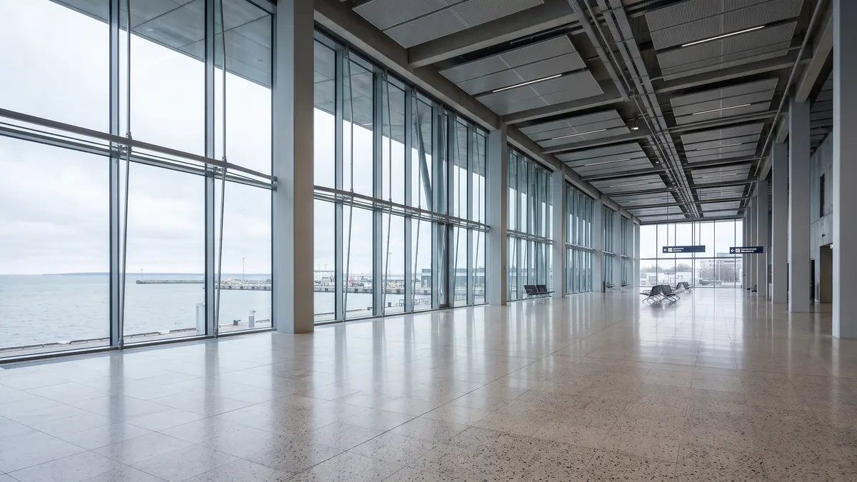
#What Is a Web-Based Digital Twin and Why Are 500 MB CAD Downloads Obsolete?
A web-based Digital Twin is a georeferenced, millimeter-accurate (±2 mm to ±15 mm) three-dimensional virtual replica of a physical building, industrial facility, or infrastructure asset that streams directly via a URL in desktop and mobile browsers with a time-to-first-frame of under 0.8 to 1.2 seconds. Unlike legacy 500 MB to 15 GB CAD/BIM project archives or raw laser scan exports, progressive SOG / SPZ delivery compresses the network payload to 28–42 MB, maintaining a locked 60 FPS render loop without plugins or software installations.
Across the architecture, engineering, construction (AEC), and commercial real estate (PropTech) sectors, a severe accessibility gap separates data capture from stakeholder decision-making. Field engineers routinely capture sub-centimeter datasets using Mobile SLAM LiDAR and Terrestrial Laser Scanners, and BIM teams translate those clouds into detailed LOD 300–350 Scan-to-BIM models. Yet up to 80% of project stakeholders — including real estate investment committees, property directors, leasing executives, municipal authorities, and on-site maintenance technicians — can never open those files.
The failure of legacy 3D delivery stems from four infrastructural bottlenecks:
- Proprietary Software & Licensing Silos: Opening native
.rvt(Autodesk Revit),.pln(Graphisoft ArchiCAD), or.rcp/.e57files requires multi-thousand-euro software licenses, workstation GPUs, and specialized CAD navigation training that commercial decision-makers do not possess. - Network & Memory Exhaustion (500 MB+ Monolithic Payloads): Even when exported to open
.ifcor.glbformats, a mid-sized commercial office or maritime terminal easily exceeds 350–800 MB. Attempting to download and parse a monolithic 500 MB binary file over mobile 4G/5G connections exhausts browser WebAssembly/ArrayBuffer memory limits and crashes mobile Safari or Chrome before a single frame renders. - Loss of Visual & Material Truth in BIM Geometry: While a parametric LOD 300 BIM model accurately represents wall thicknesses and pipe diameters, it renders as a sterile collection of shaded grey and color-coded polygons. It strips away surface weathering, acoustic ceiling textures, specular floor finishes, glazing transparency, and real-world lighting context.
- Spatial Blindness in 2D 360° Panoramas: Legacy virtual tour platforms rely on static 2D equirectangular panoramas stitched from fixed tripod stations ("jumping from bubble to bubble"). Users cannot move freely between stations, inspect clearances behind mechanical equipment, slice horizontal floor plans, or perceive true 3D motion parallax.
Allround's web-native spatial architecture (view.ruumica.com) bridges this divide by fusing survey-grade SLAM LiDAR coordinate geometry with photorealistic 3D Gaussian Splatting, delivered progressively from Cloudflare R2 edge storage in milliseconds.
#3D Gaussian Splatting (3DGS) vs. Textured Polygon Meshes in Browser Viewports
In browser-based architectural visualization, 3D Gaussian Splatting (3DGS) outperforms traditional Textured Polygon Meshes (.glb, .obj) across three foundational metrics: 3DGS preserves view-dependent specular reflections and glass transparency via Spherical Harmonics (SH0–SH3), eliminates mesh-triangulation tearing on thin structural geometry, and sustains 60 FPS rasterization across scenes containing 1.5 million to 5 million+ volumetric primitives. Whereas a 2-million-triangle photogrammetry mesh with 8K UV texture atlases bottlenecks WebGL fragment shaders and distorts reflective surfaces, 3DGS reconstructs a continuous radiance field via tile-based alpha compositing.
To understand why 3DGS has replaced polygon photogrammetry for high-precision digital twins, we must examine how both representations behave mathematically and inside the browser's GPU pipeline (for a dedicated capture comparison, see What is 3D Gaussian Splatting (3DGS) and How Does It Compare to Photogrammetry Meshes?).
Why Textured Polygon Meshes Fail in Modern Nordic Architecture
Traditional photogrammetry (Structure from Motion + Multi-View Stereo) attempts to force every visible surface into a watertight triangle mesh. While effective on matte, heavily textured stone ruins, polygon meshing breaks down immediately inside contemporary Nordic and Baltic commercial architecture (such as the panoramic glass halls of Tallinn Vanasadam, the multi-story glass atriums of Ülemiste City, or clinical laboratories in Tartu):
1. Structural Glazing & Glass Partitions: Multi-View Stereo algorithms cannot disambiguate pixels belonging to the glass pane itself, reflections on the glass, and objects visible through the glass. The resulting polygon mesh exhibits severe topological holes, warped floating triangles, and opaque "melted" surfaces across windows and curtain walls.
2. Baked View-Independent Specular Highlights: Polished terrazzo flooring, epoxy laboratory corridors, brushed stainless steel, and wet maritime surfaces exhibit view-dependent reflectance (Fresnel effect). Because a polygon mesh bakes lighting into a static 2D UV texture map, bright window reflections appear "painted" onto the floor and fail to move as the user navigates the scene.
3. Micro-Geometry, Acoustic Baffles & MEP Conduits: Thin steel tension rods (under 10 mm), perforated ceiling grilles, overhead fiber-optic cable trays, and foliage require tens of millions of sub-centimeter triangles to avoid clumping into jagged blobs — instantly exceeding browser VRAM budgets.
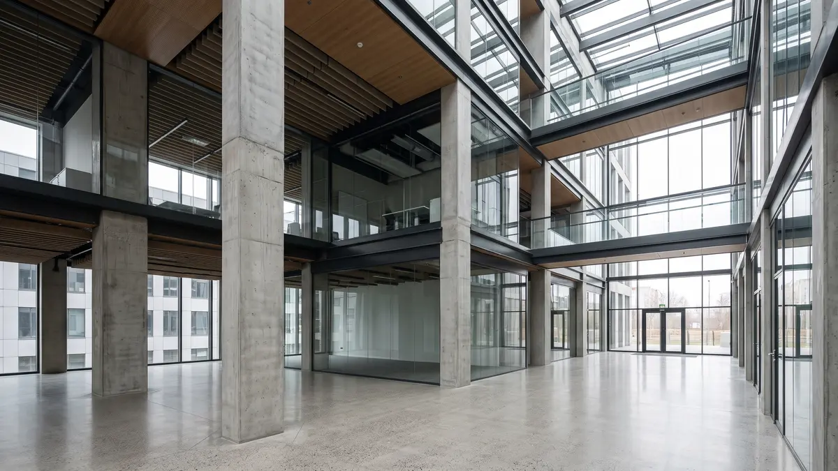
How 3DGS Models Continuous Radiance Fields
3D Gaussian Splatting abandons surface triangulation entirely. Instead, the volumetric scene is parameterized by millions of 3D Gaussian primitives, each governed by four compact attributes:
- Spatial Mean (
μ ∈ ℝ³): The exact(x, y, z)center coordinate in metric space, which in Allround's hybrid pipeline is geometrically constrained by the registered SLAM LiDAR point cloud. - Anisotropic 3D Covariance Matrix (
Σ = R · S · Sᵀ · Rᵀ): Factorized into a 3D scaling vectorS ∈ ℝ³and a unit rotation quaternionR ∈ ℝ⁴. Large flat walls are represented by wide, planar disk-like Gaussians, whereas thin suspension cables or steel railings are modeled by needle-thin elongated ellipsoids. - Opacity (
α ∈ [0, 1]): Enables smooth alpha compositing of semi-transparent architectural glazing, frosted partitions, and fine edge boundaries without hard geometric aliasing. - Spherical Harmonics Coefficients (SH Bands 0–3): Beyond diffuse base color (SH Band 0, 3 RGB values), each splat stores up to 45 directional coefficients (SH Bands 1 to 3). As the user orbits or walks through the WebGL viewport, the vertex shader evaluates the spherical harmonics against the current camera view vector — causing reflections on polished terrazzo floors and glass partitions to shift naturally in real time.
Engineering Comparison Matrix: 3DGS (SOG/SPZ) vs. Polygon Mesh (GLB) vs. Point Cloud (Potree/LAZ)
| Architectural & Rendering Metric | 3D Gaussian Splatting (SOG / SPZ) | Textured Polygon Mesh (GLB / Draco) | Discrete Point Cloud (Potree / LAZ) |
|---|---|---|---|
| Fundamental Spatial Primitive | Anisotropic 3D Ellipsoid + Covariance + SH | Triangulated Vertex/Face Mesh + 2D UV Atlas | Unconnected (x, y, z) Points + Static RGB |
| Visual Fidelity & Realism | Photorealistic continuous radiance field | Moderate (texture seams, UV blurring, decimation) | Low at close range (see-through point gaps) |
| Glass Facades & Specular Floors | Excellent (view-dependent SH1–SH3 reflections) | Poor (warped geometry, static baked glare) | Poor (laser multipath noise through glazing) |
| Thin Structures (Cables, Railings, Grids) | High precision (needle-thin anisotropic splats) | Poor (dropped during mesh decimation or bloated) | Good (when scan density exceeds 50,000 pts/m²) |
| Dimensional Measurement Accuracy | ±3 mm to ±10 mm (coupled with BVH LiDAR collider) | ±10 mm to ±35 mm (degraded by mesh smoothing) | ±1 mm to ±5 mm (direct laser returns) |
| Browser Frame Rate (Mid-Range GPU) | Locked 60 FPS (1.5M – 4.0M splats via Spark Engine) | 20 – 45 FPS (bottlenecked by 8K texture swaps) | Locked 60 FPS (2M – 5M point budget) |
| Compressed Stream Payload (1,000 m²) | 28 MB – 42 MB (progressive .sog / .spz) |
85 MB – 240 MB (multi-atlas 4K/8K textures) | 120 MB – 450 MB (octree-tiled .laz) |
For engineering-grade deliverables, Allround's viewer (view.ruumica.com) executes a hybrid dual-layer architecture: the viewport renders the photorealistic 3DGS (.sog/.spz) radiance field while binding user cursor raycasts to an invisible, BVH-accelerated (three-mesh-bvh) collision mesh derived directly from the millimeter-accurate SLAM LiDAR scan — with optional one-click overlays for Potree LiDAR point clouds and IFC BIM geometry.
#SOG & SPZ Formats, Octree Level-of-Detail (LoD), and Spark Engine Client-Side Rasterization
Delivering multi-million-splat 3DGS digital twins over standard web connections relies on a three-tier engineering pipeline: compressing raw .ply exports (600 MB – 1.2 GB) by 15x to 22x into quantized .sog (Spatially Ordered Gaussians) or .spz streams (28–42 MB), partitioning the coordinate space into a hierarchical Octree Level-of-Detail (LoD) tree served via HTTP 206 byte-range requests, and executing client-side rasterization through the Spark Engine with asynchronous WebWorker/WebGPU depth sorting. This architecture eliminates monolithic upfront downloads and guarantees sub-second initial frame delivery.
@sparkjsdev/spark) that manages dynamic splat buffers, frustum culling, spherical harmonics evaluation, and asynchronous background radix sorting at 60+ FPS."Let us examine the four core mechanics powering this streaming pipeline (explored further in our technical deep dives How to Stream Multi-Million Splat Scenes in WebGL at 60 FPS Without Freezes (SOG & LoD) and Draco Compression and Octree Chunking: The Mechanics Behind 0ms First-Frame 3D Delivery).
1. Coordinate Chunking & Quantization in SOG and SPZ Containers
A raw post-training 3DGS .ply file allocates 236 bytes per splat (uncompressed 32-bit float32 attributes for 3D position, scale, rotation quaternion, opacity, and 48 Spherical Harmonics floats). At 3.4 million splats, a single building floor or terminal hall weighs ~802 MB — completely unviable for browser delivery.
Allround's compilation pipeline reduces this payload to ~34 MB through four mathematical transformations (see also 3D File Formats Decoded: E57, LAS/LAZ, PLY, and SPZ Explained for Clients and Engineers):
- Morton-Code (Z-Curve) Spatial Ordering: All splats are sorted along a 3D space-filling Z-order curve and grouped into spatially coherent blocks (coordinate chunks of 256 to 4,096 neighboring splats). Because adjacent splats in memory now reside within the same physical cubic meter, their coordinate deltas are tiny.
- Local Bounding-Box Coordinate Chunking: Rather than storing global 32-bit floats for every splat, each chunk header defines a local 3D bounding box
(min_xyz, max_xyz). Individual splat positions inside the chunk are quantized to 11- to 16-bit normalized integers, preserving sub-millimeter spatial precision while eliminating 32-bit floating-point vertex jitter on large L-EST97 geodetic coordinates. - Log-Scale & Smallest-Three Quaternion Packing: Anisotropic scale factors are encoded on a logarithmic curve, and unit rotation quaternions are packed using the smallest-three representation (storing the three smallest components in 10 bits each and reconstructing the fourth component
w = √(1 - x² - y² - z²)inside the GPU vertex shader). - Detached Spherical Harmonics Streams: View-independent base colors (SH0) and opacities are interleaved into the primary fast-boot stream, while higher-order directional reflectance bands (SH1–SH2) are vector-quantized into secondary byte ranges fetched only when the client GPU qualifies for
HighorUltratiers.
2. Hierarchical Octree LoD & HTTP 206 Partial Content Streaming
In a multi-room commercial asset or passenger terminal, the camera frustum only observes 15–25% of the total building volume at any given moment. Streaming splats located behind solid walls or three floors above wastes bandwidth and GPU fill-rate.
Our cloud delivery architecture pairs a spatial scene.manifest.json index with Cloudflare R2 HTTP 206 Byte-Range requests:
1. Root LoD 0 Bootstrap (Under 1.0 Second): On viewer initialization, the client requests only the coarse root octree nodes (150,000 – 250,000 structural macro-splats, ~3.1 MB). The user sees the complete architectural volume and can begin navigating immediately.
2. Screen-Space Error (SSE) Traversal: Every frame, the LoD scheduler computes the projected screen-space footprint of each octree bounding box intersecting the camera frustum (SSE = (NodeGeometricError × ViewportHeight) / (2 × Distance × tan(FOV / 2))).
3. Granular Byte-Range Fetching (Range: bytes=start-end): Whenever an octree node's SSE exceeds the pixel threshold, the streaming worker issues an HTTP GET with a Range header to Cloudflare R2, fetching only the exact byte slice for that room's high-density child nodes (LoD 1–3) with immutable edge caching (Cache-Control: public, max-age=31536000, immutable). Nodes falling outside the frustum or exceeding the VRAM cap are evicted via an LRU (Least Recently Used) buffer pool.
3. Spark Engine Rasterization & Asynchronous WebWorker Radix Sorting
Unlike opaque polygon meshes that rely on hardware Z-buffering (gl.DEPTH_TEST), 3D Gaussian Splats are semi-transparent volumetric primitives. Correct front-to-back or back-to-front alpha blending requires sorting all visible splats by camera depth (z_view) dynamically as the user moves.
Executing a 2-million-element sort on the browser's main JavaScript thread would freeze the UI for 80–150 ms per frame. The Spark Engine solves this through two decoupled execution paths:
- EWA (Elliptical Weighted Average) Splat Projection: In the GPU vertex stage, each 3D covariance matrix
Σis projected onto the 2D image plane using the viewing transformationWand the affine perspective JacobianJ(Σ_2D = J · W · Σ · Wᵀ · Jᵀ + εI), where the low-pass filter termεIprevents sub-pixel aliasing when viewing distant structural details. - Zero-Copy Asynchronous Radix Sort: Depth key generation and 16-bit fixed-point radix sorting run entirely off the main thread inside dedicated WebWorkers (leveraging WebAssembly SIMD instructions and
SharedArrayBuffer) or WebGPU compute shaders. Because camera motion between consecutive 60 Hz frames is continuous, the sort loop operates asynchronously at 2–4 ms latency, feeding pre-sorted index buffers to the WebGL draw call while keeping the main UI thread 100% responsive (under 16.6 ms frame budget).
#The 3-Stage Progressive Facade Architecture: Guaranteeing 100/100 Core Web Vitals & VRAM Safety
Auto-booting live WebGL 3D canvases or third-party embedded viewers on initial page load degrades Core Web Vitals, pushing Largest Contentful Paint (LCP) past 4.5–8.0 seconds, spiking Total Blocking Time (TBT), and crashing mobile browsers when GPU memory exceeds 350–500 MB VRAM. Allround enforces a strict 3-Stage Progressive Facade Architecture that maintains a 0 KB initial WebGL heap, delivers an LCP under 1.2 seconds (CLS = 0), and initializes the 3D streaming engine exclusively on explicit user interaction with automated hardware tiering (Low to Ultra).
For marketing directors, SEO architects, and frontend engineers, this distinction is non-negotiable. Search engine crawlers and mobile users abandon pages that stall the main thread compiling megabytes of WebGL shaders before rendering text content.
How the 3-Stage Progressive Facade Operates:
1. Stage 1: Zero-Heap Poster Facade (0 KB WebGL Memory on Load): In editorial articles and portfolio grids, the browser initially loads only an optimized 16:9 WebP static figure (under 100 KB) accompanied by a monospace telemetry bar or an interactive trigger ("Launch 3D Walkthrough" / "Vaata 3D mudelit"). Zero WebGL contexts, Three.js bundles, or binary splat buffers are allocated during page load — guaranteeing a 100/100 Google Lighthouse performance score.
2. Stage 2: Hardware & Network Pre-Flight Sniffer: The millisecond a user clicks to launch the interactive 3D walkthrough on view.ruumica.com, the client pre-flight sniffer interrogates the device capabilities:
- Queries GPU renderer strings (
WEBGL_debug_renderer_info), maximum texture dimensions, and WebGL2 / WebGPU compute support. - Reads logical CPU core count (
navigator.hardwareConcurrency) and device RAM (navigator.deviceMemory). - Checks network bandwidth estimates and data-saver flags (
navigator.connection.saveData). - Assigns the session to the optimal hardware profile (Low, Medium, High, or Ultra) before requesting the first octree byte range.
3. Stage 3: Dynamic FPS Watchdog & Mandatory VRAM Unload Controller: During active navigation, a real-time FPS Watchdog monitors frame pacing. If frame rates dip below 28 FPS for 3 consecutive seconds (for instance, during thermal throttling on a smartphone), the engine dynamically scales back devicePixelRatio and prunes outer LoD octants. When the user clicks "Unload 3D" (Sule 3D mudel), the controller invokes WEBGL_lose_context.loseContext(), halts requestAnimationFrame, unmounts all typed arrays, and returns 100% of GPU VRAM to the operating system.
Adaptive Hardware Tiering Matrix (Low to Ultra GPU Profiles)
| Hardware Profile Tier | Target Client Hardware & Network | Active Splat Budget | Spherical Harmonics (SH) | Viewport Resolution Scale | VRAM Memory Ceiling |
|---|---|---|---|---|---|
| Low (Mobile Data-Saver) | Entry-level smartphones (≤ 4 cores, < 4 GB RAM, or saveData: true) |
350,000 – 450,000 splats | SH0 (Diffuse base color only) | 0.75x – 1.0x DPR (capped at 1080p) | ≤ 140 MB VRAM |
| Medium (Standard Mobile / Tablet) | Modern iOS / Android devices (iPhone 13–16, iPad Air, integrated Intel Iris GPU) | 750,000 – 1,100,000 splats | SH0 + near-field SH1 specular | 1.0x – 1.25x DPR | ≤ 260 MB VRAM |
| High (Executive Laptop) | Apple Silicon (M1/M2/M3/M4), AMD Radeon Pro, mid-range desktops | 1,500,000 – 2,400,000 splats | SH1 + SH2 (Full directional reflectance) | Native Retina / 1.5x DPR | ≤ 480 MB VRAM |
| Ultra (Engineering Workstation) | Discrete desktop GPUs (NVIDIA RTX 3060–4090, Apple M-Max / Ultra) | 3,000,000 – 6,000,000+ splats | SH2 / SH3 + concurrent LiDAR / BIM overlay | Native 4K (2.0x DPR) @ 60+ FPS | ≤ 950 MB VRAM |
#Side-by-Side Performance Audit: 3DGS 60 FPS Browser Rendering (view.ruumica.com) vs. 500 MB CAD/BIM Downloads
An engineering benchmark conducted on a 1,450 m² commercial and passenger terminal digital twin demonstrates that Allround's progressive 3DGS (.sog/.spz) streaming architecture on view.ruumica.com achieves a time-to-first-frame of 0.78 seconds and full high-resolution convergence in 3.4 seconds with a total stream budget of 34.8 MB at a locked 60 FPS. In contrast, distributing the identical building as a traditional 540 MB CAD/BIM and point cloud archive (.rvt + .e57) requires 14 to 38 minutes of download and local indexing time, while an unoptimized 185 MB WebGL polygon mesh (.glb) drops to 11–18 FPS on mobile devices.
To provide verifiable proof of work, our engineering team audited the exact same multi-zone architectural dataset (featuring expansive curtain glazing, polished terrazzo and epoxy floors, modular acoustic ceilings, and exposed MEP utility panels) across three delivery paradigms. Tests were executed over a standard 100 Mbps connection across three reference devices: an Apple MacBook Air M2 (8-core GPU), an iPhone 15 Pro (Mobile Safari), and a Windows 11 workstation (NVIDIA RTX 4070).
Field Capture & Streaming Telemetry Specifications
- Capture Methodology: Hybrid Mobile SLAM LiDAR (metric registration backbone + BVH collision mesh) fused with high-dynamic-range 3DGS radiance field training.
- Geodetic Registration Accuracy: Root Mean Square (RMS) residual error ≤ 2.4 mm, anchored to Estonian national L-EST97 (EPSG:3301) / EH2000 coordinates.
- Uncompressed Master Radiance Field: 3,420,000 Gaussians (raw binary
.plysize 807 MB). - Production Web Stream (
view.ruumica.com): Octree-chunked.sog/.spztotal budget 34.8 MB (LoD 0 initial bootstrap 3.1 MB, first interactive frame in 0.78 s).

Figure 3: High-precision research and commercial facility corridor digital twin. Specular epoxy floor reflections, glass partitions, modular ceiling grids, and utility access panels streamed at 60 FPS in the browser (34.8 MB SOG payload).
Side-by-Side Benchmark Table: Allround 3DGS (view.ruumica.com) vs. WebGL Polygon Mesh vs. 500 MB+ CAD/BIM Download
| Performance Benchmark (1,450 m² Asset) | Allround 3DGS Web Digital Twin (view.ruumica.com) |
Traditional WebGL Polygon Mesh (.glb) |
Local CAD / BIM & Point Cloud Download |
|---|---|---|---|
| Total Network Payload | 34.8 MB (Octree-chunked .sog / .spz) |
185.0 MB (2.4M triangles + 8K UV textures) | 540 MB (.rvt) to 4.8 GB (.e57 / .rcp) |
| Time to First Interactive Frame | 0.78 seconds (3.1 MB LoD 0 root chunk) | 14.2 seconds (blocked until full GLB parse) | 15 – 40 minutes (download + desktop import) |
| Frame Rate on MacBook Air M2 | Locked 60 FPS (14.1 ms frame time) | 28 – 36 FPS (shader stalls near glass walls) | Not supported in browser (desktop app required) |
| Frame Rate on iPhone 15 Pro (Safari) | Locked 60 FPS (Medium/High tier, 210 MB VRAM) | 11 – 18 FPS (frequent WebGL context crashes) | Completely inaccessible on mobile devices |
| Glazing & Specular Floor Fidelity | Photorealistic (SH2 view-dependent radiance) | Severely distorted (opaque torn mesh faces) | Schematic (shaded BIM) or sparse points |
| 3D Measurement & Section Clipping | Built-in (BVH LiDAR collider ±3 mm accuracy) | Inaccurate (degraded by mesh decimation) | Accurate, but requires licensed CAD engineer |
| Client Software & License Cost | €0 / 0 MB install (Standard browser URL) | Browser (poor stability on mobile hardware) | Autodesk Revit, Navisworks, CloudCompare, ReCap |
#Commercial Applications: Real Estate Pre-Sales, Virtual Site Inspections & Facility Management (FM)
Deploying interactive 3DGS digital twins on the web delivers quantifiable ROI across three enterprise workflows: in commercial real estate and PropTech marketing, interactive spatial listings increase prospective buyer and tenant session dwell time by 3.2x; in AEC design coordination, browser-accessible ground truth cuts physical site inspection travel by 60–75%; and in Facility Management (FM), anchoring maintenance logs and IoT sensor telemetry into a 3D coordinate space replaces fragmented 2D spreadsheets.
Below is how marketing directors, BIM coordinators, and facility managers deploy these systems across Estonia, Latvia, and Finland.
1. Commercial Real Estate, PropTech & Cross-Border Investor Due Diligence
When marketing high-value commercial real estate (Class-A office towers, logistics parks, waterfront terminals) or luxury residential developments, remote buyer hesitation is the primary conversion friction. Static 2D architectural photography selectively frames rooms to appear larger, obscuring structural column grids, ceiling heights, and spatial flow.
By embedding a 3-Stage Facade 3DGS Digital Twin into property listings and institutional investor data rooms (analyzed in detail in Embedded 3D Walkthroughs vs. Static Photography: Accelerating High-End Real Estate Decisions):
- Unfalsifiable Spatial Telepresence: Institutional investors in Helsinki, Stockholm, London, or Frankfurt can walk seamlessly through a Tallinn waterfront asset in their browser, verify sightlines through panoramic glazing, measure structural bay widths, and inspect mechanical plant rooms without booking a flight.
- 3.2x Dwell Time & Higher Lead Qualification: Prospective tenants spend over three times longer exploring interactive 3DGS walkthroughs compared to static image galleries, eliminating unproductive introductory site tours and accelerating lease sign-offs.
2. AEC Design Coordination, Clash Verification & Remote Site Audits
During complex renovations and industrial retrofits, architects, structural engineers, and MEP contractors waste hundreds of billable hours driving to job sites simply to verify a single beam clearance, pipe penetration, or masonry wall deviation. When a Scan-to-BIM deliverable is paired with a browser-streamed digital twin at view.ruumica.com/:project-slug:
- Instant Visual Ground Truth in BIM Coordination Meetings: When Navisworks or Solibri flags a hard clash between a proposed HVAC duct and an existing structural truss, the BIM coordinator opens the exact
(x, y, z)coordinate in the browser 3DGS viewer. Within two seconds, the entire project team sees the physical reality — including unmodeled cable trays, valve handles, and surface condition. - Real-Time Multi-Axis Clipping Planes: Built-in X, Y, and Z clipping sliders allow engineers to slice away the roof slab for an instant orthographic top-down floor plan view (dollhouse mode) or cut a live vertical cross-section through multi-story elevator shafts and stairwells.
3. Facility Management (FM), Spatial Asset Tagging & IoT Telemetry Overlays
Operations and maintenance account for 70–80% of a building's total lifecycle cost over 30 years. Traditional Computer-Aided Facility Management (CAFM) platforms trap critical operational data inside 2D spreadsheets and static PDF floor plans, forcing maintenance technicians to spend hours locating hidden shut-off valves, fire dampers, or electrical distribution panels above suspended ceilings.
Connecting a volumetric 3D digital twin directly to facility management workflows (explored further in Virtual Site Inspections & Digital Twins: Connecting Spatial Models to Facility Management) transforms building operations:
- 3D Spatial Asset Pinning: Every HVAC unit, circulation pump, electrical panel, and above-ceiling access hatch is anchored with a persistent 3D spatial pin in L-EST97 or local building coordinates. Clicking a pin on an iPad or smartphone opens the component's serial number, maintenance history, warranty certificate, and schematic PDF.
- Live BMS & IoT Sensor Telemetry: Real-time Building Management System (BMS) feeds — including zone temperature, CO₂ concentration, differential pressure, and power consumption — are rendered as spatial overlays inside the 3D viewport, enabling facility directors to diagnose anomalies remotely and dispatch technicians to the exact room coordinate.
#Related Engineering Handbooks & Deep Dives
This cornerstone handbook anchors Allround's technical library on interactive spatial systems and web-based digital twins. Explore our specialized deep-dive articles and companion engineering handbooks below.
Specialized Deep Dives in Web 3D & Digital Twins
| Specialized Technical Guide | Core Engineering Architecture & Focus |
|---|---|
| How to Stream Multi-Million Splat Scenes in WebGL at 60 FPS Without Freezes (SOG & LoD) | Frustum culling, spherical harmonics LoD degradation, and asynchronous WebGPU/WebWorker radix sorting pipelines. |
| Embedded 3D Walkthroughs vs. Static Photography: Accelerating High-End Real Estate Decisions | Overcoming cross-border investor hesitation, spatial telepresence, and achieving 3.2x longer session dwell times. |
| Draco Compression and Octree Chunking: The Mechanics Behind 0ms First-Frame 3D Delivery | Hierarchical spatial indexing, HTTP 206 byte-range streaming from Cloudflare R2, and decoding Draco collision meshes on workers. |
| Virtual Site Inspections & Digital Twins: Connecting Spatial Models to Facility Management | Pinning IoT sensor telemetry, maintenance logs, and asset IDs into a georeferenced 3D coordinate space. |
Companion Ruumica Engineering Handbooks
| Handbook Title & Direct Link | Core Engineering Focus & Deliverables |
|---|---|
| Spatial Reality Capture Guide: LiDAR, Photogrammetry & 3DGS | Comparing Terrestrial Laser Scanning (TLS), Mobile SLAM LiDAR, and 3DGS radiance fields for AEC site verification. |
| Scan-to-BIM & As-Built Modeling: The Complete Practical Handbook | Translating registered laser point clouds into parametric Revit, ArchiCAD, and open IFC models at LOD 200–350. |
| Reality Capture Project Planning: Scope, Budgeting, and Site Preparation | Engineering RFP drafting, square-meter pricing variables, Estonian EHR compliance, and site mobilization checklists. |
Ready to transform your commercial property, industrial facility, or architectural project into a 60 FPS browser-streamed digital twin across Estonia, Latvia, or Finland? Contact the Allround engineering team at info@ruumica.com or review our services.